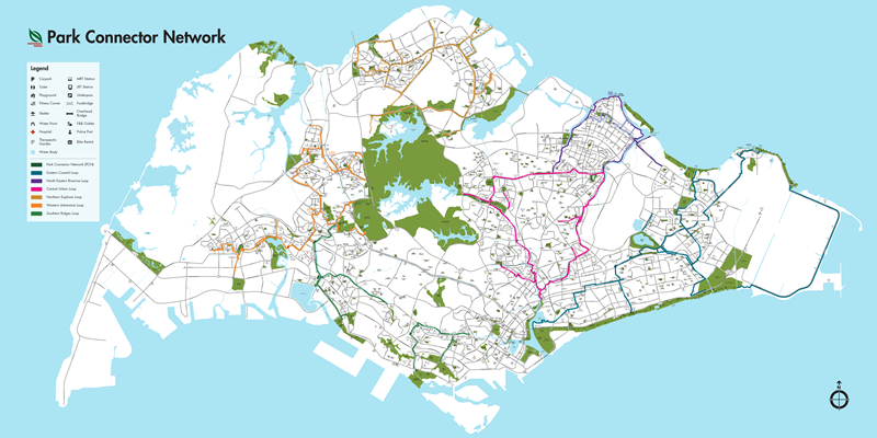
The Park Connector Network (PCN) is pretty self-explanatory: it connects the many parks of Singapore in a vast network of pedestrian/cycling paths! It is composed of 6 main loops (Central Urban, Eastern Coastal, North Eastern Riverine, Northern Explorer, Southern Ridges, and Western Adventure) and around 65-70 individual connectors for a total length of ~300 km. Most paths are asphalt, with painted yellow markings:
The layout of the PCN is shown below and more information can be found on the Singapore National Parks Board (NParks) website:

The PCN is very helpful for avoiding the bustling city roads. Cyclists do need to watch out for pedestrians and vice versa as some sections of the PCN have merged pedestrian and bicycle traffic. Many community-made maps detailing PCN features also exist, such as:

Hi, this is a comment.
To get started with moderating, editing, and deleting comments, please visit the Comments screen in the dashboard.
Commenter avatars come from Gravatar.